WHAT: This is TxDOT's 10-year plan and budget. It is based on information and requests from regional planning bodies like the Houston-Galveston Area Council in Houston. The Texas Transportation Commission (TTC) approves the plan, and TxDOT carries it out.
The 2023 UTP public comment period is July 8, 2022, through 4:00 p.m. CST on Aug. 8, 2022. You may submit comments using the following methods:
Fill out a comment form online.
The online comment form can be switched between several of the most spoken languages in Texas, including English, Spanish, Vietnamese, Hindi, Arabic, Chinese Mandarin, and Cantonese.
You may also print a comment form or request a printed comment form at your local TxDOT district or area office and mail it to:
Texas Department of Transportation
Attention: TPP-UTP
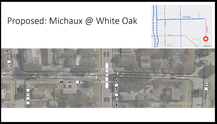
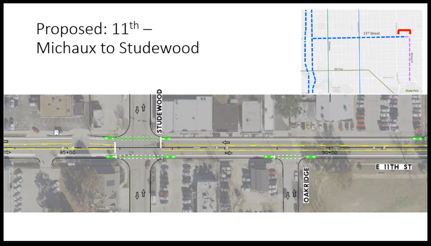
125 E 11th Street
Austin, Texas 78701
You may e-mail your public comments to UTP-PublicComments@txdot.gov. Additionally, you may leave a voicemail comment by calling 833-933-0446.
Please be prepared to state your city, state, and zip code. Your name and address are optional. Please speak as clearly as possible, comments are transcribed and added to the official record.
In order to be considered, comments must be received by 4:00 p.m. on Aug. 8, 2022.
Talking points to consider:
Remove the I-45 & I-10 Expansion from the UTP to allow for a new project based on a true community engagement process. In the meantime, for communities that were harmed by the initial construction of I-45, their concerns should be addressed and mitigated immediately. These reparations should not be held hostage to a plan that will sacrifice more Houstonians to flooding, pollution, and traffic violence.
No more added lanes for cars for any projects through urban centers
Prioritize safety of all road users and Vision Zero
All projects should prioritize sustainability and aim to reduce vehicle miles traveled (VMTs)
All projects should center and aim for race and class equity for all road users
All projects should reduce flooding and prioritize flood mitigation
We want a UTP that increases multi-modal transportation options throughout the state
Updates to the TxDOT ADA Transition Plan have included work to identify the specific need and cost of bringing all TxDOT on-system facilities up to inclusive ADA standards. This TxDOT assessment estimated that adding or fixing all on-system missing and broken sidewalks, ramps and safe crossings across the state would cost $1.56 billion. We request that you increase the funding for the ADA Transition Plan from the proposed $5 million to $25 million a year in the FY2023 Unified Transportation Program.
2023 Unified Transportation Program
UTP Presentation - https://ftp.txdot.gov/pub/txdot/tpp/utp/2023-utp-public-meeting-with-speaker-notes.pdf
Virtual Public Hearing, July 26 at 2pm. Link is HERE.