The WHCA board would like to start a new feature providing periodic updates of infrastructure-related issues, both big and small, happening in and around the neighborhood. Infrastructure projects require both vision and funding. So we want to keep everyone informed of, not only what is going on, but how those projects are being funded. We’d also like to use this feature to invite feedback on infrastructure projects that you would like to see to improve the safety and enjoyment of our neighborhood. Email us at infrastructure@woodland-heights.org.
So what’s going on? Here are a few things . . .
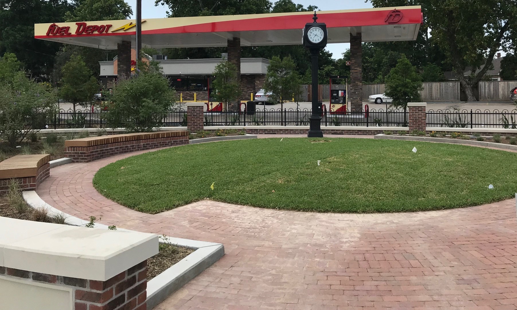
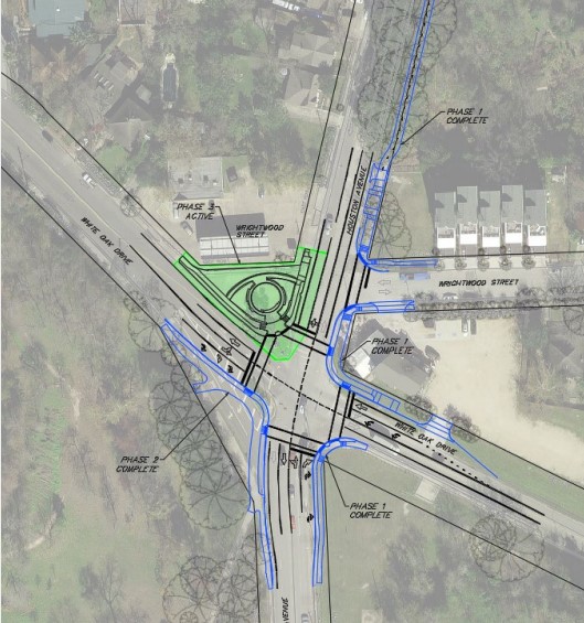
Houston Ave & White Oak Intersection Nears Completion
If you haven’t seen it yet, the construction is almost finished at the intersection of Houston Ave and White Oak. The City removed the “slip road” connecting White Oak to Houston Ave, widened the sidewalks connecting Woodland Park to the White Oak Bayou Trail, and generally improved the pedestrian and cyclist infrastructure to make the intersection safer for all road users. There is even some green “kermit” striping for a bike lane. And, in case you were wondering, the clock tower is back in.
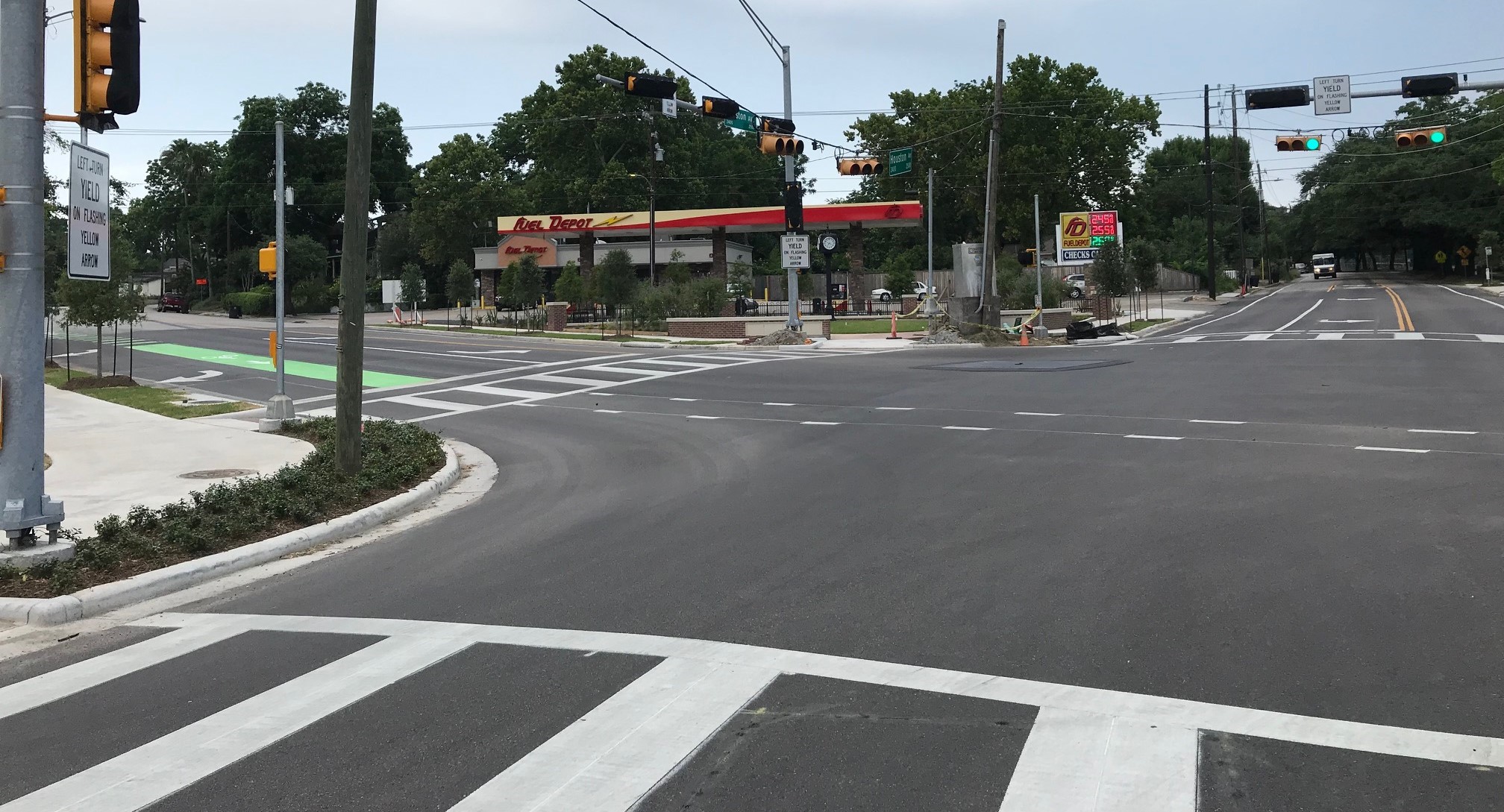
How was this project funded? It was primarily a combination of funds from Tax Increment Reinvestment Zone # 5—or TIRZ 5—and the Greater Northside Management District. For those who don’t know, a “TIRZ” is a political entity in the City limits that retains a portion of property taxes within its district. TIRZ 5 is called “Memorial Heights,” which primarily covers areas surrounding Buffalo Bayou and White Oak Bayou. It does not cover our neighborhood, but it comes close. On the other hand, the Greater Northside Management District covers our neighborhood and most of the Heights East of Yale and South of North Main. It’s funded by a property tax on local commercial businesses.
You can find more information on TIRZ 5 at https://www.houstontx.gov/ecodev/tirz/5.html and on the Greater Northside Management District at http://www.greaternorthsidedistrict.org/home.shtml.
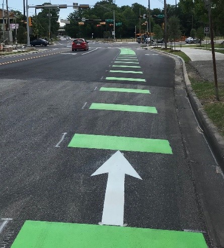
Road Diet and Bike Lane on Houston Ave (White Oak to Spring Street)
Remember the temporary bike lane on Houston Ave during recent construction to I-45? Thanks to City Council Member Karla Cisneros, that bike lane has been made permanent. She used funds from City Council District H to reduce the lanes on Houston Ave between White Oak and Spring Street from four to two (i.e., a “road diet”), and to install protected bike lanes on both sides of the street. This can be a key “North/South” connector between the two bayou trails. They call the barriers “armadillos.”

You can find more information about both of these projects from a local blogger: http://houstreets.com/2019/06/03/houston-ave-white-oak-dr-redesign-complete/
More B-Cycle Stations
On Wednesday, May 30, 2019, Houston B-Cycle installed two new stations in the Heights. The first is at 11th Street and Heights Blvd (Heights Central Station) and the second is at 7th and Yale (Heights Mercantile). That brings the total number of stations in the Heights to five (Woodland Park, Stude Park, Bobcat Teddy’s, Heights Central Station, and Heights Mercantile), with a number of additional stations just outside of our area.
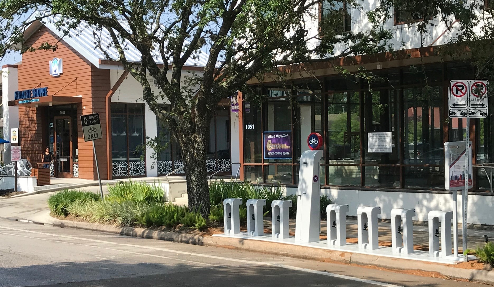
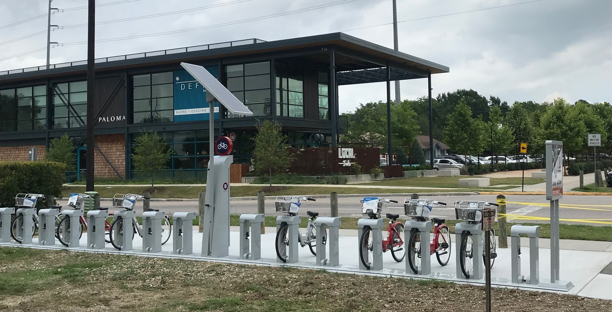
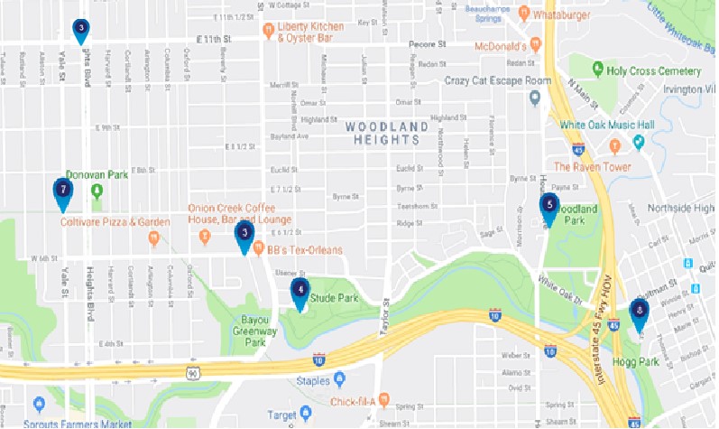
You may ask why at these locations? Because these developers helped fund the stations. Houston B-Cycle is currently operating on a large grant that requires local funding for 50% of each station, which ranges from $10-20k. You can find the full map B-Cycle station map here: http://houston.bcycle.com/station-map. Where else would you like to see a B-Cycle station in our neighborhood?
That’s it for now. We’d love to hear from you about infrastructure projects you’d like to see in and around the neighborhood. And please let us know of current or future projects you hear about. Again, email us at infrastructure@woodland-heights.org.
Brad Snead
WHCA Director of Infrastructure