Woodland Heights Boundary Map, Houston, Texas.
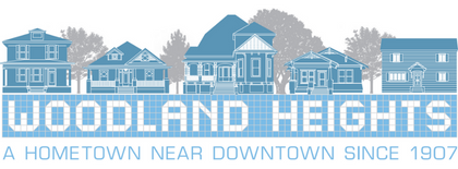
The Woodland Heights
Woodland Heights was born in 1907 on 106 acres of high ground just north of downtown Houston and White Oak Bayou. Developers were attracted to the area by nearby Woodland Park (then called Highland Park), a popular 30-acre spot with a lake and other amenities that drew visitors from across the city.
From the start, Woodland Heights was envisioned as a special neighborhood with easy access to downtown jobs and shopping. The William Wilson Realty Company platted the land as a streetcar suburb because of the proximity of Houston Electric Company public transportation. Streetcars ran through the neighborhood until bus service was introduced in 1939.
Making a Neighborhood
To ensure Woodland Heights’ success, its developers incorporated elements they deemed essential to a viable modern neighborhood, including water piped into every house, sewers, cement sidewalks, graded streets, shrubs, trees and parks. Gate piers at Bayland and Houston Avenues marked the entrance. Bayland itself is a prime example of the importance the William Wilson Realty Company placed on green spaces. The street was lined with oak and sycamore trees that were watered regularly by horse-drawn water wagons until they were established early in the century. Now the trees are eye-catching canopies that curve over the avenue.
The developers also provided for education in the community by deeding land to the single-room Beauchamp Springs Public School, giving it a permanent home in 1909. The building, which became the William B. Travis Elementary School, underwent major renovation in 2005 focused on preserving the original brick structure.
In October 1907, Woodland Heights’ boundaries were Omar to the north, Julian on the west, Houston Avenue to the east, and White Oak Avenue (today’s Byrne) on the south. The 35-acre Bayland Orphanage compound, originally intended for orphans of Civil War veterans, started at Julian and Bayland. This was the western border of the Woodland Heights until fire destroyed the orphanage building in 1914, the institution relocated near Bellaire, and the land became part of the Woodland Heights. Bayland Avenue is named for the orphanage.
Today, the neighborhood encompasses approximately 2,000 homes in 61 different developments that range from a few houses to several hundred. Some of the major sections beyond the original neighborhood boundaries are Highland Park, Woodland Heights Annex, Grota Homestead, Norhill, Woodland Terrace and Willborg. Current boundaries are Pecore Street on the north, Studewood Street to the west, Interstate 45 on the east and Interstate 10 to the south.
Business Boom
Although Woodland Heights was designed as a bedroom community and remained primarily residential, businesses were established in the neighborhood as well. Five main business centers developed:
Houston Avenue, north of White Oak Bayou
Beauchamp Avenue, up to North Main
White Oak Drive, from Houston Avenue to Studewood
Studewood, from Little White Oak Bayou to 11th/Pecore
Teetshorn/North Sabine District
Reportedly, the Houston Avenue business center was the earliest to emerge. From Houston Avenue’s long-gone Highland Park Hotel, located next to the park and home to a theatre, saloon, restaurant and beer garden, to the still-standing Woodland Drug Company, business boomed in the early days of the Woodland Heights. Numerous buildings that housed neighborhood businesses survive even though the original business has changed or the structure converted to living space.
Historic Structures
Many historic structures in Woodland Heights built between 1907 and 1925 remain. The homes primarily reflect the Queen Anne, craftsman and English cottage architectural styles popular just after the turn of the century among the more modest middle class. House styles are predominately bungalows, cottages and four squares with most featuring the generous front porches so important to the social conventions of the era and personal comfort in Houston’s pre-air-conditioned climate.
The oldest churches still serving the community include St. Mark’s United Methodist Church on Pecore, which can be traced to Germantown and the Emanuel German Methodist Episcopal Church in 1875, and Zion Lutheran Church on Beauchamp that was completed in 1915.
Hogg Middle School has been operating as a junior high since it opened in 1926 and, while no longer in use, the existing Woodland Masonic Lodge #1157, AF&AM structure built in 1928 endures.
Surviving historic Woodland Heights homes include the Klunkert Farmhouse, which dates back to 1875, and the Wilson Home at 205 Bayland, the only example of prairie style-influenced architecture in the neighborhood. William A. Wilson was the only original Woodland Heights developer to actually live there, and he did it in a big way, building the largest and grandest home in the Woodland Heights. He and his family lived in the house until his death in the late 1920s. Another twenty of the homes he built still stand.
Renovated and restored to its original grandeur in 2007, the Wilson Home serves as an enduring monument to the vision that turned the Woodland Heights into a thriving hometown neighborhood near downtown.
The Past as Present
Today, Woodland Heights remains one of the most charming neighborhoods in Houston. Walking paths with downtown views wind past softball fields, a public swimming pool and historic houses.
Visitors still flock to the area. Each December for one evening, the Woodland Heights Civic Association hosts Lights in the Heights, 14 blocks of luminaria, entertainment, refreshments and carriage rides. Each spring, the neighborhood hosts a home tour.
After falling on economic hard times in the later half of the 20th century, Woodland Heights’ revival began about 20 years ago as its historic charm and central location spurred a renaissance. But all through the years, despite economic ups and downs, neighbors reveled in a commitment to community. Today, we continue to celebrate our diversity and strive to preserve our heritage.